A mountain rescue app that keeps working where the signal stops.
Mountain rescue teams in England, Wales and Scotland are volunteers who work where phones were never meant to: ridges, gullies, moorland miles beyond the last mast. Sinkaos gives every team member the map, the plan and the team on the device, records where everyone went, and syncs it all when someone gets back into range.
The hill does not care about your coverage map.
Someone dials 999 and asks for the police, then mountain rescue. The police take the details, decide a search is needed and call out the team: a walker overdue on a ridge route, light fading, wind picking up. The team leader has a rough last known position, a phone number that goes to voicemail and a dozen volunteers heading for the road end.
From there the coordination usually runs on radio, paper maps and memory. Which gully has team two already covered? Was the glove found at the col or below it? When the casualty is found, a six or eight figure grid reference is read over a crackling channel, written down and read out again. Afterwards nobody can say with confidence which ground was searched and which was not.
An overdue walker on a winter ridge.
-
15:40The call comes inThe police call out the team. The team leader opens an operation from the team’s ridge search template, with roles, map layers and forms already in place. The last known position goes on the map.TemplatesRoles
-
15:55Segments and packsThe leader draws search segments along the likely routes and assigns them. Each phone downloads its mission pack while members are still in the valley with signal.SectorsMission packsOffline maps
-
16:30On the ridge, no barsTeams move up with tracks recording on their phones. They see their segment, the last known positions of the other teams and their own grid reference in MGRS or UTM.TracksMGRSOffline
-
17:05A glove at the colTeam two logs an observation with a photo and position, which queues on the phone while the team radios a short message and keeps going.ObservationsQueue
-
17:50The picture fills inAs teams drop back into coverage, their tracks and reports arrive and go onto the timeline at the time they were made. The leader sees which segments are done and narrows the search.SyncTwo timestamps
-
18:40Found, and the record staysThe casualty is found and stretchered down, or flown off when the police and the Coastguard bring in a search and rescue helicopter. Later the team replays the callout and exports the tracks as GPX for the debrief.ReplayExportDebrief
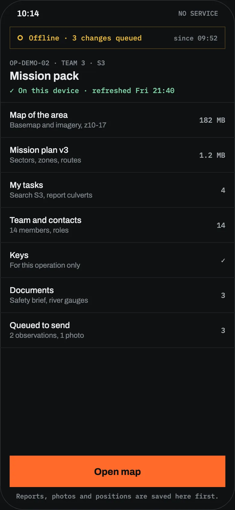
What each team member carries.
Maps that live on the phone
Vector and raster offline maps for the team’s area, including your own tile sources and orthophoto, with offline place and coordinate search.
Grid references people trust
Positions in MGRS, UTM or WGS 84, shown the way each member prefers. Copy a reference instead of reading it out twice. Most UK teams talk in OS grid references, so check with us which formats your patch needs.
Tracks as evidence of coverage
Every member’s path is recorded with time and accuracy, so the leader can see what ground was actually covered, and gaps are shown as gaps.
Reports that wait for signal
Observations, photos and messages are saved on the device and sent oldest first when a link appears. The app says plainly what is still waiting.
A base without internet
A laptop at the team base or in the team vehicle can run a disconnected node that phones reach over local Wi-Fi, and that syncs with the hosted service later.
Kit and qualifications
Ropes, stretchers and radios with inspections and expiry, plus who is in date on casualty care or winter skills, kept in the same workspace between callouts.
Limits on the hill.
What mountain teams use it for.
What mountain teams want to know.
How large can an offline area be?
Can the police or neighbouring teams see our picture?
Do the tracks help in a debrief?
Does it replace our callout system?
Bring it on your next exercise on the hill.
Early access is free. We will prepare offline packs for your patch with you before the first callout.