When the water is rising, nobody has time to ask where team three is.
Floods, storms, missing-person searches and large exercises. Professionals and volunteers working the same area, often with patchy coverage.
The plan is on paper, the updates are on the radio, and the picture is in one person’s head.
A response grows fast. Teams arrive from different organisations, each with its own channels. The coordinator rebuilds the situation from phone calls and radio traffic, and anything written down is out of date by the time it is read.
Coverage is worst exactly where the work is: in valleys, in buildings, at the edge of the affected area. Tools that need a connection stop being useful at the moment they matter most.
A river flood exercise, from the evening before to the debrief.
-
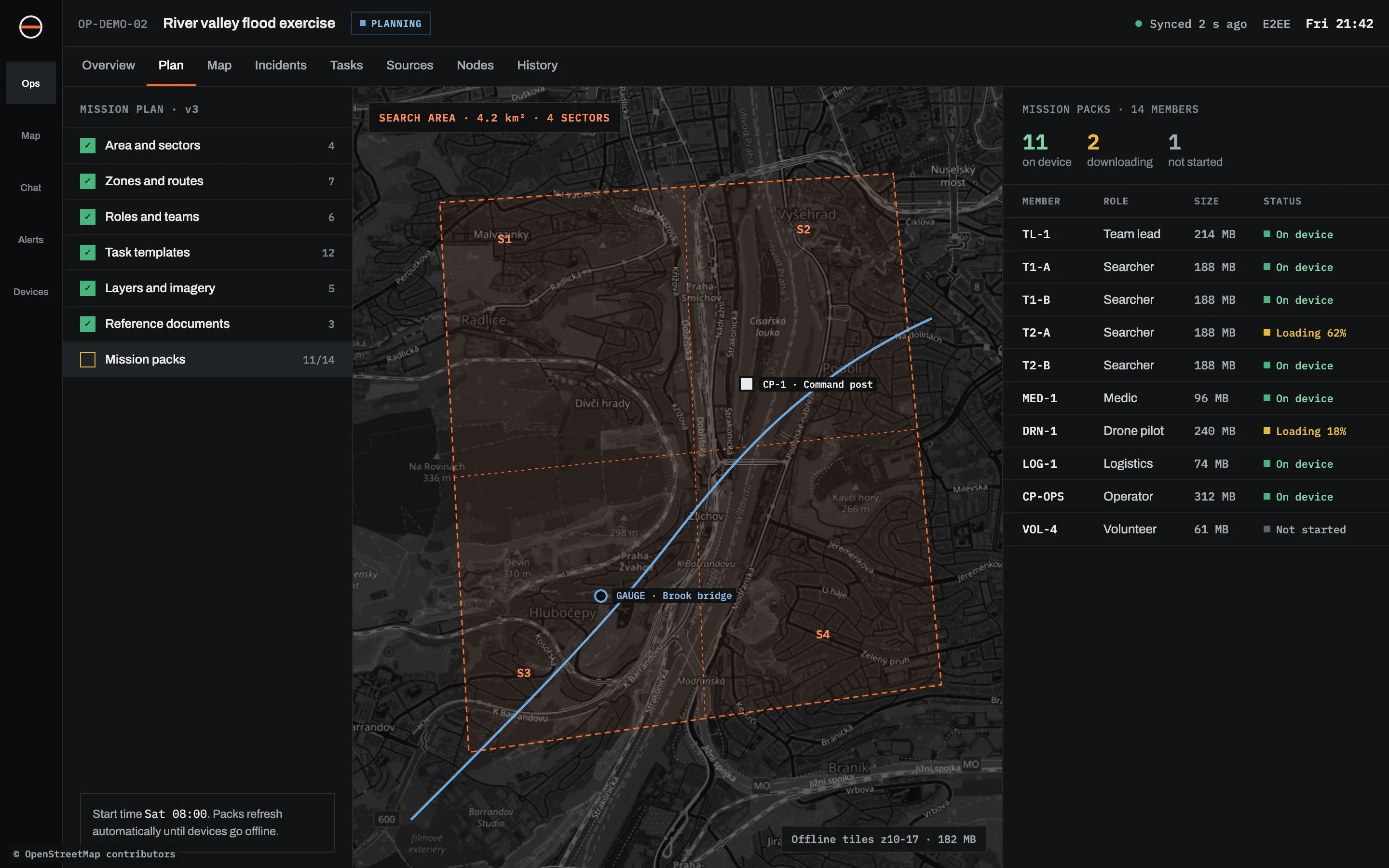
FriThe coordinator prepares the operationSearch area split into four sectors, the command post, the river gauge, evacuation routes. Roles for team leads, searchers, medics and the drone pilot.PreparationRoles
-
21:40Every phone has its packFourteen members, each with offline maps, their sector, their tasks and the team list. The coordinator sees two still downloading and calls them.Mission packs
-
08:15Teams go out and lose signalTeam three works the upper valley with no coverage. They log a blocked culvert with a photo and keep going. It waits in the queue.ObservationsOffline
-
09:30The gauge crosses its watch levelAn alert opens for everyone with access to the river sectors. The drone feed from sector S3 is attached to it.SensorsAlertsCameras
-
10:05Team three comes back into rangeTheir reports arrive and go onto the timeline at the time they were made, marked as late. The coordinator sees the culvert report from 08:40.SyncTimeline
-
15:00Debrief from the recordReplay the day, check the gaps, export the timeline for the exercise report.ReplayExport
Sinkaos is not a certified emergency dispatch or alerting system and does not replace official emergency numbers or public warning channels.
It works alongside radio. It doesn’t replace it.
Can volunteers from other organisations join?
How much storage does a pack need?
Does it need its own server?
Run your next one on Sinkaos.
Tell us what you have planned. We'll reply within two working days.